


A1 AIATSIS Map of Indigenous Australia
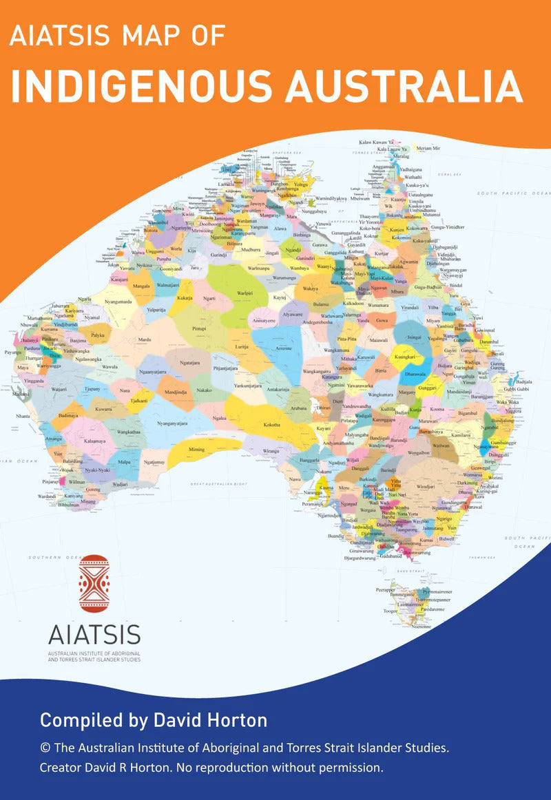
This A3 map is produced by the Australian Institute of Aboriginal and Torres Strait Islander Studies (AIATSIS) to show the geographical parameters of traditional Country.
Aboriginal and Torres Strait Islander Australia is made up of many different and distinct groups, each with their own culture, customs, language and laws. This map represents the general locations of these groups, their languages and more; but not exact or fixed boundaries.
The map was originally created in 1996 as part of the Encyclopaedia of Aboriginal Australia and some of the information shown on the map remains contested today.
Disclaimer: This map attempts to represent the language, social or nation groups of Aboriginal Australia. It shows only the general locations of larger groupings of people which may include clans, dialects or individual languages in a group. It used published resources from the eighteenth century-1994 and is not intended to be exact, nor the boundaries fixed. It is not suitable for native title or other land claims.
David R Horton (creator), © AIATSIS, 1996. No reproduction without permission.
Materials: Paper
Dimensions: 29.7 x 42 cm
We offer a flat rate shipping fee of $12 on all domestic orders.
Visit our Shipping and delivery page for more information.